The last atmospheric river in the series. Will Seattle break the November precipitation record?
The third atmospheric river in a sequence will be directed towards our region tomorrow.
Examining the situation, I was impressed by the rate at which this atmospheric river will be moving moisture into our region.
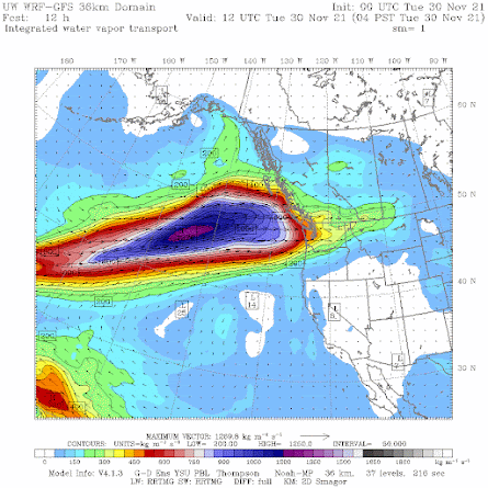
Specifically, the integrated water vapor transport (IVT), the product of water vapor and wind speed, is predicted to reach extraordinary levels tomorrow morning off our coast (see figure below). Blue is high. Purple levels are quite unusual, as is the great north-south extent of this moisture plume.
It is also coming almost from due west, rather than from the southwest as was true of most of the moisture plumes this fall.
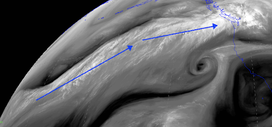
And the moisture/water vapor "river" of this event extends THOUSANDS of miles across the Pacific (see below). Essentially from the Philippines to our door.
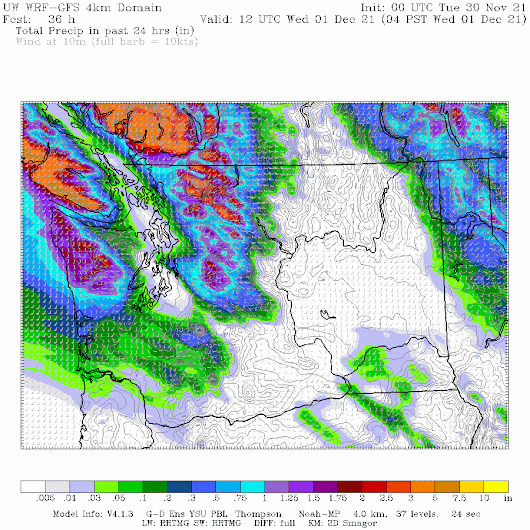
The precipitation for the 24 h ending 4 AM Wednesday is predominantly over southwest BC and Northwest Washington, with huge contrasts (see below).
Virtually nothing over the lowlands from Olympia to the San Juans, as air descends the coastal terrain. There is one exception...a narrow Puget Sound Convergence Zone feature over Seattle. Precipitation increases over southwest Washington where there is less high terrain to the west...and thus less rain shadowing.


Comments
Post a Comment