Extraordinary Cold in Store for The Pacific Northwest
It will not be a little ironic that a year that brought record-breaking high temperatures in June, also brings extreme cold in December.
But life is full of contradictions and ironies.....

The latest model runs suggest that immediately after Christmas temperatures will plummet to levels not seen in our region for perhaps decades.
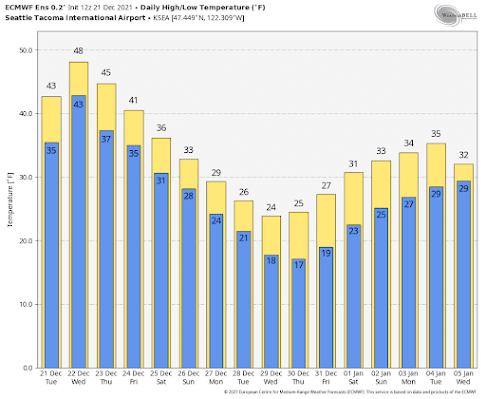
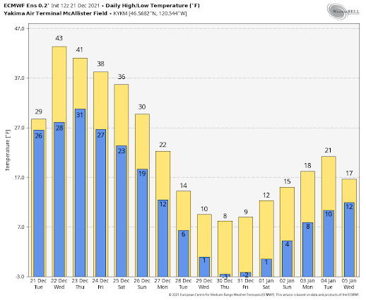
Let's begin with the European Center ensemble forecasts....averages of many runs from the best global prediction center in the world.
For Seattle-Tacoma Airport, highs only reaching the mid-20s, and lows in the teens--something we haven't seen in several years. A totally hard freeze.
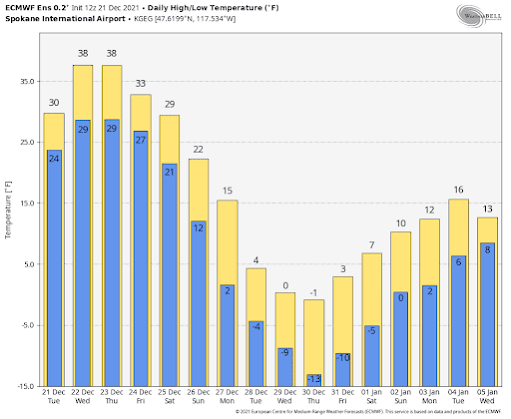
And do I dare show you the forecasts for Spokane? Where one day never gets above zero?
Extreme high pressure over the northeast Pacific.
Extreme cold (white and purple colors) over the interior of BC and just east of the Rockies.
And frigid temperatures (blue colors) over the Northwest.
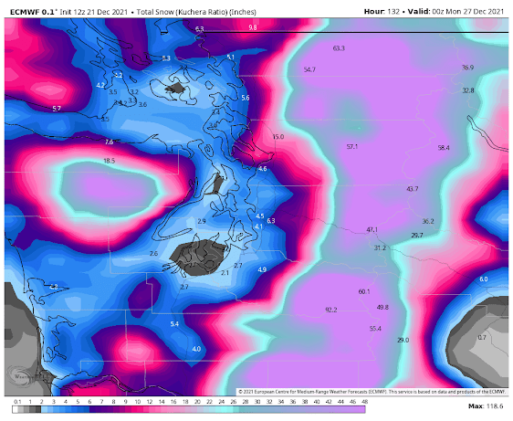
Maybe not on the ground Christmas morning. But the chances for snow AFTER Christmas looks favorable. The total snowfall (not accumulation) through Sunday at 4 PM is roughly 2-4 inches around Puget Sound. More on that in future blogs, particularly since there is still considerable uncertainty in the snow forecast.
But you can bank on cold air coming...so get ready.
Outdoor faucets should have hoses removed. Pets should be moved inside. And local agencies have to get homeless folks off the streets...this period will be cold enough to be life-threatening.


Comments
Post a Comment