Code Red on the Oregon Coast
Don't worry, this time code red is a good thing.
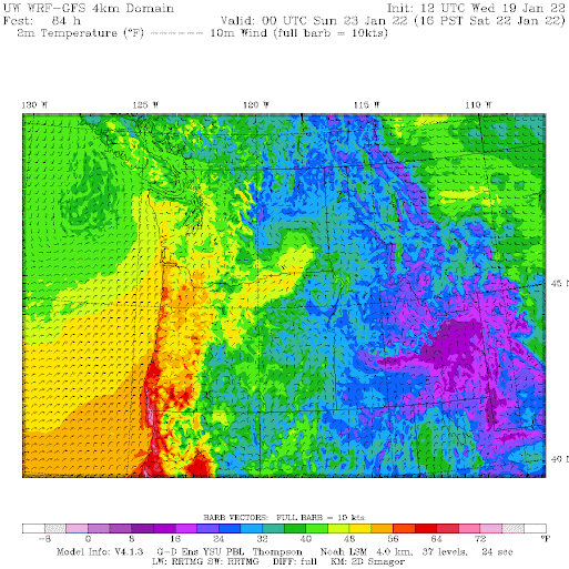
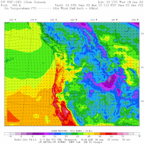
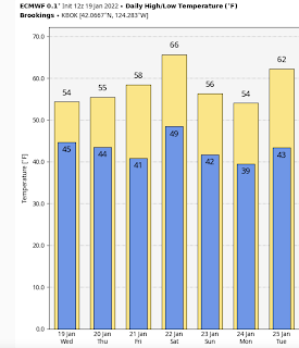
Below is the latest high-resolution surface temperature forecast for Saturday at 4 PM. Red colors are temperatures above 60F along the Oregon coast! The kind of code red I like. And near Brookings, just north of the Oregon/CA border temperatures surge into the mid-to-upper 60s.
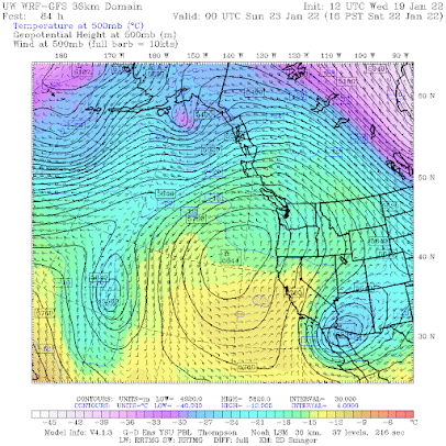
Our "code red" temperatures are associated with a high-amplitude upper-level (500 hPa) ridge over the northeast Pacific, with two "bookend" troughs on both sides (see below). This is a very stable pattern.
First, high-pressure areas are associated with sinking air that prevents mid-level and upper-level clouds. More sun! And the sinking air is also warmed by compression.
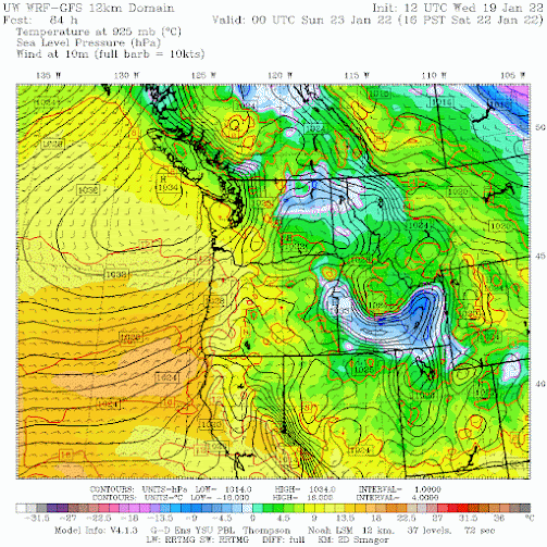
But to really understand the implication of the upper high pressure, let's examine its reflection at the surface, illustrated by the forecast sea level pressure pattern at 4 PM Saturday (shown below). The surface high is centered just offshore of central Vancouver Island, with northeasterly flow (winds from the northeast) to its southwest over coastal Oregon.
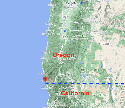
Northeasterly winds can sink over the western slopes of the Cascades and coastal terrain, producing MORE compression and warming. Brookings is in the "banana belt" for a reason...it is downstream an area of continuous high terrain, extending all the way from the coast to the Cascade crest (see below). So when the air sinks down such terrain it is very warm.
Northeasterly winds also keep the cool marine influence offshore and prevent the development of low-level fog and low clouds.
So if you can, head to the Oregon coast this weekend for sun and springtime warmth. Will be a bit cooler (mid-50s), but still decent in Long Beach, along the southern WA coast.
But the southern Oregon banana belt is where you want to be. Mid-60s and sun in mid-January is a real treat around here.


Comments
Post a Comment