Heavy Rain, Record Breaking Snow, Strong Wind and Flooding, Followed by A Break: An Update in My New Podcast
We are now experiencing one of the most active weather periods in a while.
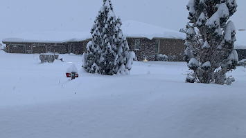
It started with several feet of snow in the Cascades and its eastern slopes, which closed all cross-Cascade passes and dumped record snows from Ellensburg to Wenatchee (where the ALL-TIME record 24-h snow record--about 2 feet-- was broken). The regional snowpack is now way above normal.
Near Wenatchee Thursday Afternoon Courtesy fo Tom Callahan
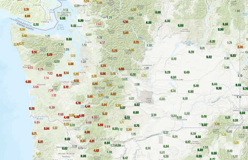
Precipitation? HUGE amounts (see below, click to expand) of up to ten inches over southwest Washington that caused river flooding, particularly for the Chehalis.
And this event ends today with a very strong cold front, behind which a damaging surge of strong westerly winds will move down the Strait, followed by strong winds descending the eastern slopes of the Cascades.
All followed by a calm, dry weekend as high pressure builds aloft.
I will talk about all of this in my podcast, as well as describe the controls of varying types of precipitation: from rain to snow to freezing rain to sleet.


Comments
Post a Comment