High Pressure's Two-Edged Sword: Heat and Cold Fog. Plus the Weekend Forecast in My New Podcast
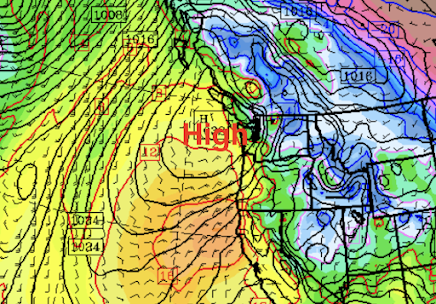
High pressure has built over the region and will strengthen on Saturday (see surface map for 4 AM Saturday morning).
Strangely enough, high pressure during the winter can have two localized impacts on our region: cool, foggy conditions in the western lowlands, OR very warm, sunny conditions where downslope flow is forced by regional terrain.
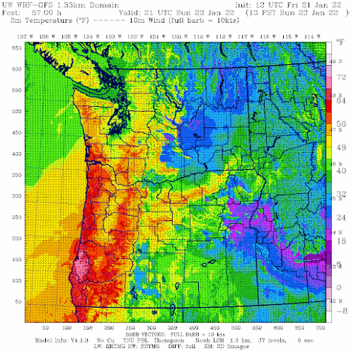
Such will be the situation this weekend, where northern Puget Sound will be dank, cloudy and cool, while the Oregon coast (and to some degree the southern WA coast) will enjoy sun and warmth. The Columbia Basin will also be caught in the murk and cold.
To illustrate the wildly varying situation, here is the forecast surface air temperature for 1 PM Sunday. Some places on the Oregon coast will get into the lower 70s, while Puget Sound will be in the lower to mid-40s. BELOW FREEZING in the Columbia Basin. Quite nice on the Long Beach Peninsula. COLD over Northwest Washington.
Want to know why such extremes occur over our region during high-pressure situations?
Or get more details about the forecast? Check out my podcast--either with the link below or through your favorite service.
You can listen to the podcast below or through your favorite podcast server.


Comments
Post a Comment