After months of jet streams, atmospheric rivers, snowstorms, cold waves, and low centers, a huge persistent ridge of high pressure will soon form along the West Coast.
But you will have to be patient. For three more days, a series of weak systems will bring precipitation to the area. But then the region will turn dry, and in one area, the Pacific Coast, the temperatures will rise to very pleasant levels. Book your room now!
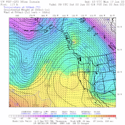
First, the ridge. On Friday, high pressure will explode over the eastern Pacific and by 1 AM Saturday, the mother of all ridges will be evident aloft (500 hPa pressure level, about 18,000 ft) shown below. Two troughs of lower pressure/heights are found on the sides. This produces an OMEGA pattern, which is very stable.
UW Model Forecast for 1 AM Saturday
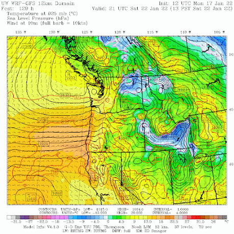
This pattern will hold in for the weekend and beyond. At the surface, high pressure will be centered just offshore of Vancouver Island and inland, producing moderate easterly flow over the coastal zone of Oregon and southwest Washington. Temperatures will warm as air sinks as it moves around the high and down the western slopes of coastal terrain (see sea level pressure map, with low-level temperatures, at 1 PM Saturday).
When I saw this chart I smiled and thought about immediately booking a room somewhere in the "banana belt" of the southern Oregon coast. Let me show you why!
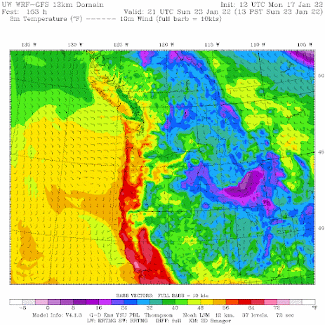
Here is the forecast of surface air temperature for 1 PM Sunday. Lots of reds--temperatures ABOVE 60F--along the coast west of the coastal terrain. Warming offshore flow. And the warmth will extend along the entire Oregon Coast and even southwest Washington (e.g., Long Beach). Folks, it will feel like summer---a guarantee it!
In contrast, below freezing air will be ensconsed in eastern Washington, probably with some fog to boot.
The southern Oregon coast....a.k.a. the Banana Belt...is famous for enjoying warm days in winter. All it takes is easterly (offshore) flow descending the regional terrain.


Comments
Post a Comment