A Major Precipitation Event Has Begun
The atmospheric river has reached the Pacific Northwest and moderate rain has spread across much of the region.
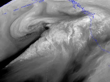
The water vapor satellite imagery is impressive, showing a potent plume of water vapor moving northeastward from off the Pacific (see below). Looks scary, doesn't it?
Some folks rate atmospheric rivers like hurricanes and tornadoes, and they rank this event as an AR4 (atmospheric river, category 4), out of a possible 5.
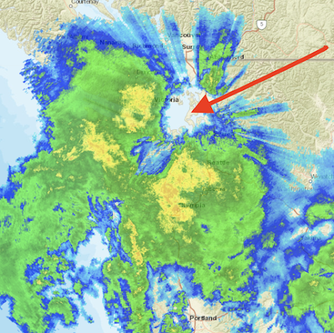
This atmospheric river not only has moisture, but strong winds from the south-southwest, producing a very impressive rainshadow to the northeast of the Olympics (see radar image at 7:30 PM below). Yellow and orange indicated the heaviest precipitation, with the southeast side of the Olympics getting the worst of it now. In contrast, it is TOTALLY dry from Sequim to northern Whidbey Island in the rain shadow. So if you want to go on an evening stroll...you know where to go.
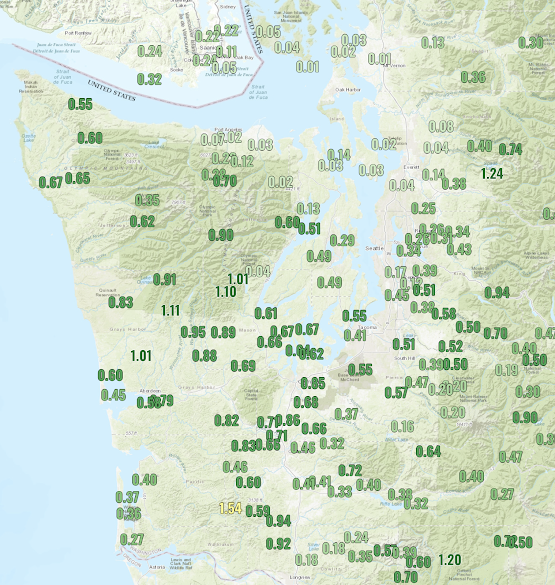
The precipitation total so far (through 7 PM) is shown below. Over an inch has accumulated on the southwest flanks of the Olympics and some favored areas in the Cascades, but only .01 inch on southern Lopez Island in the San Juans. And folks, this is just the beginning.
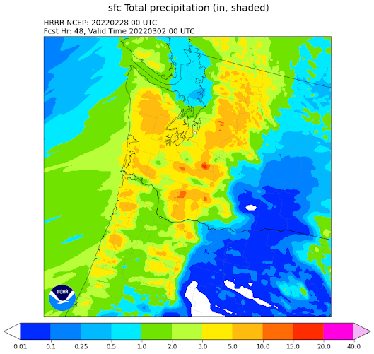
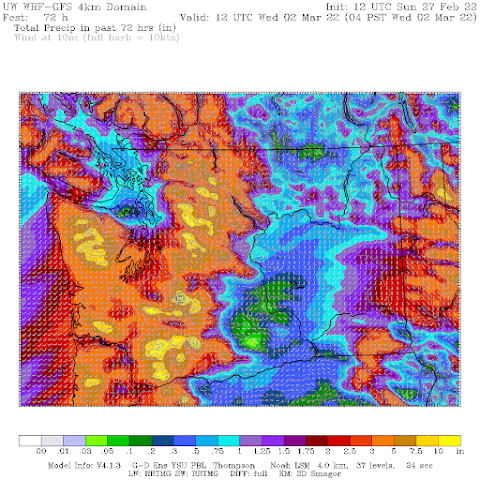
The latest precipitation forecast starting from 4 PM today (Sunday) through 4 PM Tuesday from the NOAA HRRR model predicts 5-10 inches in the mountains, with even heavier precipitation in the southern Washington Cascades. 3-5 inches over southern Puget Sound. That is unusual. Expect some urban flooding.



Comments
Post a Comment