This winter has been one with a relative paucity of strong Pacific cyclones hitting our coast.
One reason for this is the persistent La Nina pattern, with high pressure over the eastern Pacific; this pattern is not favorable for good cyclogenesis (development of low-pressure systems) off our coast.
But conditions will change later Saturday as a fairly strong storm approaches the northern Oregon coast.
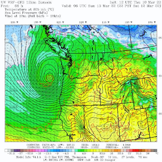
To illustrate this for you, below is a sea-level pressure forecast for 10 PM Saturday. An impressive low center (cyclone) is just off the northern Oregon coast, with an intense pressure gradient (difference) to the south and southwest of the low center. You will note the very large pressure change along the Oregon coast, one that will produce wind gusts of 40-70 mph along the coast.
A closer-in view of the predicted storm three hours early shows the classic oceanic storm structure. This map below shows the sea level pressures and predicted wind gusts at 7 PM Saturday.
The strong winds are not near the low center but in the dangerous area to the south and southwest of the lowest pressure: gusts as high as 55 knots! (63 mph). This is often called the "poisonous tail" of such storms.
So if you are looking to experience a good blow, head to Oregon on Saturday and find a hotel on the beach. You fall asleep to surges of wind and wave. Sounds wonderful to me.
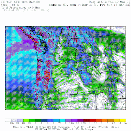
And then there is the rain. The Oregon storm will spread moderate rain over the region late and Saturday and Sunday, with the total precipitation accumulated through 5 PM Sunday shown below. Up to several inches in the mountains. Decent rain over eastern Washington and down into northern California.
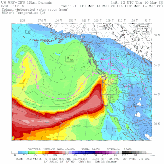
But the rain is not over then. A moderate atmospheric river of subtropical moisture will reach our coast on Monday, as illustrated by the atmospheric moisture map shown below (for Monday afternoon at 2 PM)
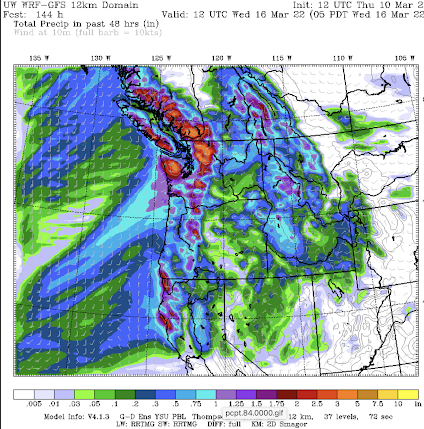
The result will be more precipitation, with the 48h precipitation total ending 5 AM Wednesday shown below. The North Cascade and Olympics get hit fairly hard (up to 3-5 inches).
The weather regime has changed and wetter/stormier conditions should be the rule.


Comments
Post a Comment