And last week, as high clouds streamed in overhead, a good example of this feature was captured by weather videographer extraordinaire Greg Johnson of Skunk Bay Weather.
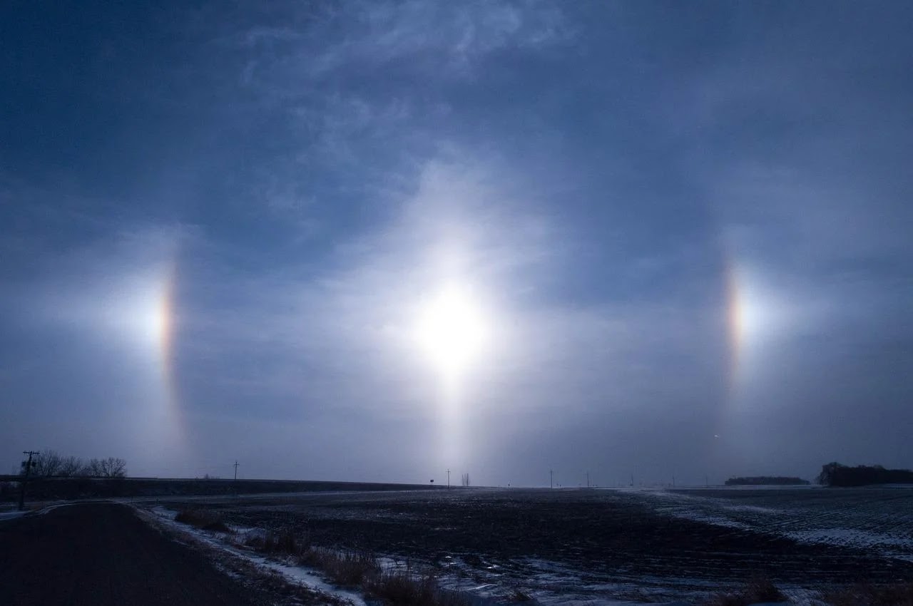
During a sundog event, areas of light are seen on both sides of the sun (see example below). These are the "dogs." Sundogs are also called "mock suns"
The ancients thought that sundogs were ominous signs, foretelling events such as the death of kings. Today we know that sundogs generally occur when the sky is filled with a thin veil of ice crystal clouds, generally cirrostratus.
Now let me show you a video captured by Greg Johnson from his location in northern Kitsap County around 6:30 AM last Wednesday. From his camera, you only see one of the dogs.
The sky at the time of sun dogs was full of high ice crystal clouds, called cirrostratus. You can see the extensive veil of such clouds from the visible satellite picture taken about this time (see below):
Why sun dogs?
They occur when ice crystals in the clouds--shaped in six-sided plates--are oriented roughly horizontally. With that orientation, they preferentially bend the light by 22 degrees, creating two areas of light (22 degrees on both sides of sun), as illustrated by the figure below.
Ice crystals that are smaller and tumbling about create circular halos.
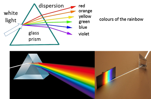
As shown in the picture above, many sundogs have rainbow colors as well, something also illustrated in the picture below.
These colors are produced by dispersion, the breaking up of visible light into its component wavelengths, as it passes through the ice crystals, not unlike what happens in a prism (see below).
Cirrostratus and associate halos and mock suns are often a sign of an approach weather system, such as a front or cyclone. Thus, although it may not foretell the death of kings, it can suggest the end of nice weather.
We have some interesting weather ahead. The key features will be the development of a strong upper-level ridge over British Columbia and a low sliding westward across southern Oregon (see upper-level map for 8 PM Sunday). Predicted 500 hPa Height at 8 PM Sunday There are some suggestions in the media and a few blogs that this situation is like June 2021. This is not correct. The shape, size, intensity and location of the high are different (and much less intense) and the low center was absent in 2021. Subtle differences are everything. So let's go through the next few days in detail. Today (Thursday) has been near perfect, with low 70s around the region at 3 PM. The predicted temperatures at 5 PM Friday are shown below. Cooler along the coast and Northwest Washington. Just reaching 80F in Seattle, but warmer (low to mid-80s) over southwest Washington and the Willamette Valley. Also low 80s in the lower Columbia Basin. 5 PM Friday On Saturday at 5 PM, high temperatures will ...
Thousands of lightning strikes have hit the Pacific Northwest during the past several days. A stormfest of lightning! Lightning over the Kitsap Peninsula Picture courtesy of Adam Sapek For the 24-h ending at 1 AM this morning (Friday), lightning was widespread over the entire region (each + or - sign is an individual lightning stroke) During the previous day, eastern Oregon and Washington enjoyed the lightning shows Wednesday had a strong band crossing northern Idaho and more over southwest Oregon While Tuesday had lightning filling southwest Washington and western Oregon. So why has the Northwest enjoyed this flashy period? Every Northwest resident instinctually knows the answer: Blame California! And they would be right. During the past several days, a low center has been parked along the California coast (see the 500hPa chart--for about 18,000 ft--from Tuesday afternoon). The winds are also shown, indicating southerly winds over the U.S. southwest and southeasterly (from the s...
There has been a lot of talk about the warmth of this weekend, but the REAL story is about the winds, not the temperatures. Unusually strong easterly winds. Today was a warm, but pleasant day for many, with Seattle getting up to the mid-80s away from the water, while highs hit around 90 from Olympia down into the Willamette Valley. But the warmth was mitigated by a wonderful breeze in many locations, with the high winds today reaching around 20 mph over western Washington/Oregon and 30-35 mph east of the Cascades. The weather situation today and tomorrow are very different from the major heatwave events and that explains the winds. Considering the upper level (500 hPa) pattern, one notes an elongated ridge of high pressure/heights to our north, which is NOT the canonical location/shape to give the Northwest a major heatwave. A further non-standard feature is a low center to our south. All of this is VERY different than the situation in June 2021. This pattern is producing an inte...


.jpeg)


Comments
Post a Comment