Modified Arctic Air Pushes into Washington After Light Snow Falls over Some Areas
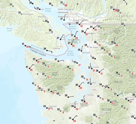
Cold air and gusty winds have surged southward into Washington State, with light snow over Northwest and Northeast Washington last night.
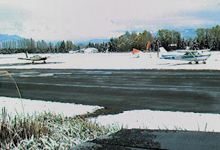
Snow was observed at Sequim Valley Airport northeast of the Olympics.
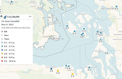
The snowfall totals, available from the cooperative CoCorahs network, showed about a 1/2 inch over the portions of the San Juans and 1-5 inches from Port Angeles to Sequim. There were some flurries over Seattle last night.
As the Fraser River outflow is forced upwards by the Olympics a band of precipitation (snow) is apparent on the radar (see example around 7 AM this morning)
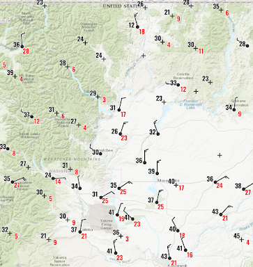
And let's not forget eastern WA, with cold, northerly winds, gusting to 25 mph, pushing southward out of BC through the Okanagon valley (see below)
This cold wave is quite a shock to the system.
It was less than a month ago (October 18th) when we almost hit 90F (see plot). During the past few days, our maximum temperature is barely reaching the normal low.
The average temperature for the past month is nearly normal 😆, illustrating the dangers of averaging weather over time.
To illustrate, here is the last graphic from the USDA snotel website.
WOW. The Olympics are over 2000% of normal and the Cascades 300 to 1000% of normal.
Snow heaven. Streamflows are generally near normal, by the way.
The next few days should be cool, often sunny, and dry as high pressure moves in.
We need the break.


Comments
Post a Comment