One Dry Record Will Be Broken. But Rain is Coming Back
Climatologically, the Northwest is now in the wettest time of the year. But that is no guarantee of cloudy, dripping skies.
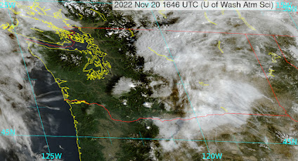
Today will represent the 13th day without measurable rain at Seattle Tacoma Airport (measurable rain is 0.01 inches of rain or more).
And in doing so we tied the record string of 13 dry days in November at SEA that occurred in 2000.
Tomorrow will be dry as well, and thus we will break the November record for consecutive dry days..
But to deflate your excitement a bit, this only ties the record that crosses over into December (November 20-December 3).
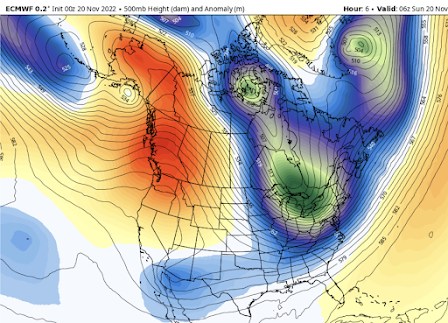
As noted, in earlier blogs, the origin of this dry bounty is a ridge of high pressure over the West Coast (see below), ironically resulting in headlines of cold/wet weather in the western U.S.
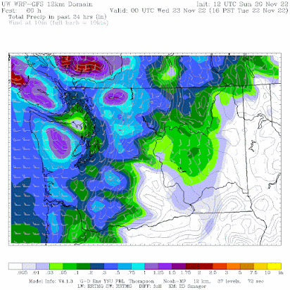
A front will break through the ridge on Tuesday bringing general rain over the region. The forecast map below shows the 24-h rainfall ending 4 PM Tuesday. No more dry records!
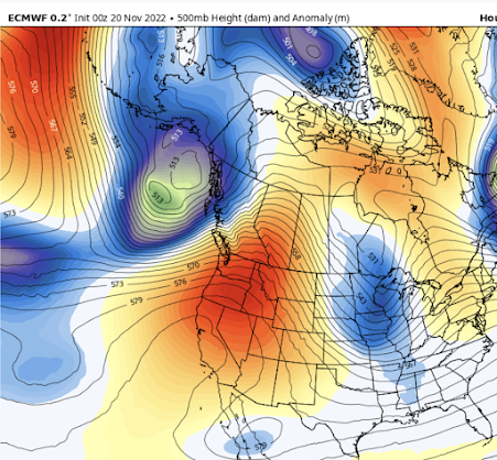
And then a miracle occurs. The ridge rebuilds late Wednesday and Thursday, leading to a dry, sunny Thanksgiving (see below). You can look forward to an invigorating pre or post-Turkey walk outside and safe travel across the Cascade passes.
But this won't last, a major shift to cool/wet conditions will still occur next weekend...more on that later.


Comments
Post a Comment