The Potential for a Major Freezing Rain Event
It is looking increasingly probable that a significant freezing rain event will occur during the next day.
Freezing rain can make driving dangerous and result in extensive power outages.
As described in my previous blog, freezing rain occurs when temperatures warm above freezing aloft but sub-freezing air remains near the surface. Raindrops fall into the sub-freezing air and can supercool to below-freezing, yet remain liquid. Such droplets can freeze on contact on a cold surface.
The Current Situation
Temperatures are well below freezing throughout the region, as shown by the map below of 2 PM temperatures.

A warm front is approaching the coast, accompanied by precipitation, as picked up by the Langley Hill Radar near the coast (see radar image). Clouds from the approaching system have already started to spread over the western side of the region and precipitation has now reached the WA southwest coast.

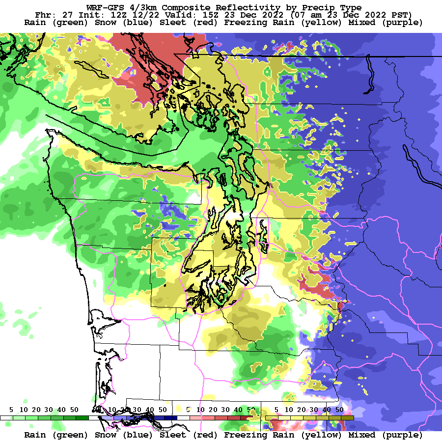
Precipitation will start as snow, then sleet, then freezing rain, and finally rain.
Let me show you some forecast graphics of the event (just produced by meteorologist Dave Ovens) from the UW high-resolution modeling system.
First, western Washington.
At 10 PM tonight, much of the inland area will see snow (blue), but freezing rain (yellow) will be moving into the coast.

By 4 AM, freezing rain will cover much of the western Washington lowlands, while snow will be occurring over the Cascades and eastern Washington.

And by 7 AM tomorrow, the freezing rain will be ending, with rain moving into the region.
Even greater potential for freezing rain exists in the Columbia Gorge and to ots west over the northern Willamette Valley. Why? Because there will be a bountiful supply of subfreezing air moving westward in the Gorge.
Below is the forecast of accumulated freezing rain by the NOAA HRRR modeling system through 8 AM tomorrow. Lots of freezing rain in Seattle south and in the Willamette Valley.


By Saturday warm, moist air will flood the region, and this cold/icy/snowy episode will be over the western side of the region.


Comments
Post a Comment