Why travel to the northern climes when Arctic air is coming to you?
High pressure and very cold air are now moving into British Columbia.
It would like to reach us, but the mountains--the Rockies and Cascades--are initially blocking it.
But like like a marginal football team, there are gaps in our defense. Literally gaps in our terrain.
And the cold offense is about to make a successful end run to score a frosty goal.
Let me show you....
The situation this morning shows cold temperatures (purple and brown colors) in the Canadian Arctic. An intense pressure change is at the interface between warm air to the southwst and cold air in the interior.
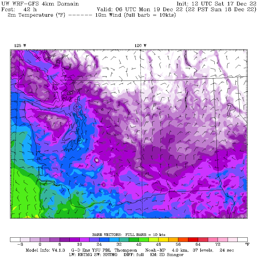
Zooming in temperatures and winds in Washington State, at 10 AM today the state was divided by Cascades (just like our politics!). Cold in the east (purple colors) and warmer in the west (green colors).
By tonight at 10 PM, much colder air moves into southern BC (while shades), and cooler air pushes through the Fraser River valley north of BC and into NW Washington.
Sunday morning at 7 AM, colder air is pushing south into the Okanagon River Valley in north central Washington and modifed arctic air is surging in the Northwest Washington, pushed by strong northeasterly winds escaping the Fraser River Valley,
The process continues through Sunday at 10 PM and if you look carefully you will see northerly winds pushing into Puget Sound. Cold air is really moving southward into eastern Washington.
What about snow tonight and tomorrow?
Precipitation is already moving into the region, but it is falling as rain over the lowlands.
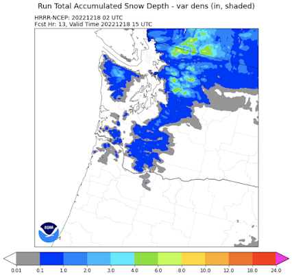
The snow total forecast through 4 AM from the NOAA HRRR model shows mountain snow, but little over the lowlands with two excptions. (see below). The first is around Bellingham, where cold air from the Fraser Valley will support light snow, and the second is on the northest side of the Olympics, where the Fraser Valley flow is forced upwards.
For the period through 4 AM Monday, there is more NW Washington snow and a band of light snow over Seattle. That is probably associated with a weak convergence zone; it totals less than 1 inch in its core. Southwest WA gets some light snow as well.
Later Sunday and Monday should be a dry, but cold period.
The next possibility for snow is late Tuesday, but at this point it appears that northwest WA is most threatened. More details in a future blow.


Comments
Post a Comment