The Upcoming Windstorm (Plus Another One This Morning)
There is a lot of wind to talk about in this blog--a significant Pacific cyclone will make landfall on the Northwest coast tomorrow....and strong winds will result.
But before I get into that, there was a blow this morning in western Washington as a powerful cold front went through from roughly 7-8 AM. Below is the Camano Island radar image at roughly 7:15 AM below, with the arc-shaped frontal feature in yellow to red.
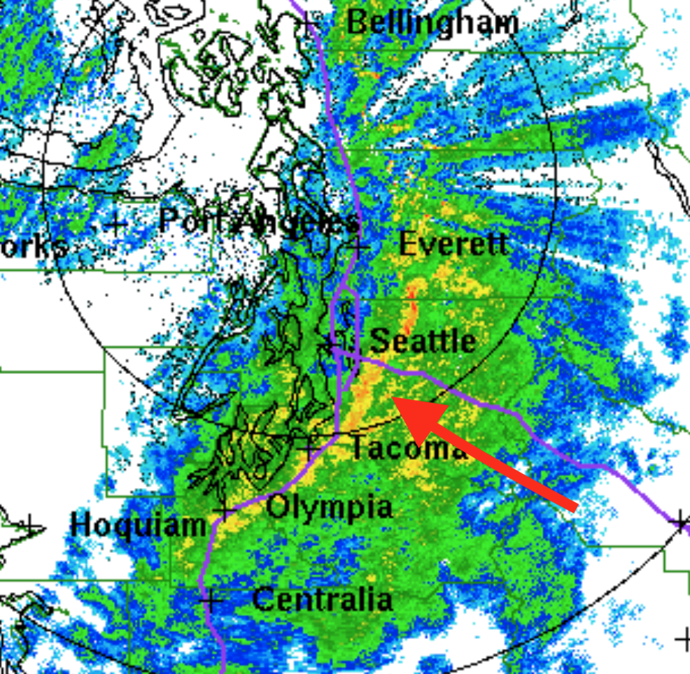
This feature is an intense narrow cold frontal rain band, and was associated with winds gusting to around 50 mph, a rapid wind shift, and a significant temperature drop. The models had it, but underplayed its strength.
The maximum winds this morning are shown below. 55 mph at SeaTac, 59 mph in Bellingham, and over 60 mph on the coast. No wonder there are about 100,000 customers out of power in the region.

But this is just a "warm up" for the event of tomorrow afternoon and evening.
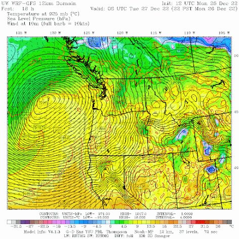
Offshore, satellite imagery shows a massive cloud feature over the northeastern Pacific, something characteristic of the stronger storms.

This is a classic structure for marine midlatitude cyclones. At that time there will be a strong north-south pressure difference and strong winds from southern Oregon to the Bay area.
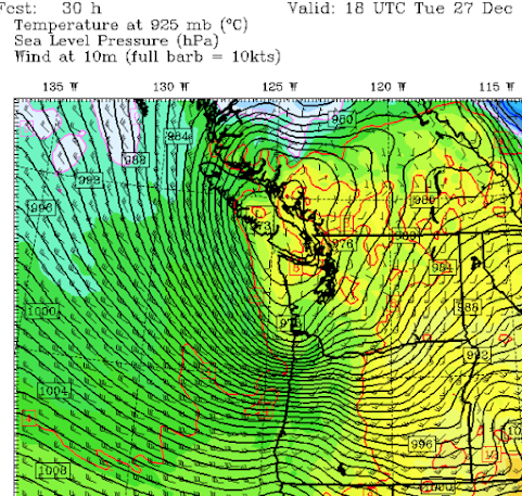
Twelve hours later (10 AM Tuesday) the low makes landfall on southern Vancouver Island and a hyper pressure gradient builds over the Oregon coast. Expect winds gusting to 60-80 mph and power outages along the coast and in the Willamette Valley at this time.
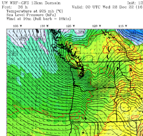


But the interior of western Washington will get its turn. By 4 PM tomorrow, the low will move into southern BC and an intense pressure gradient will develop over the western Washington lowlands, producing powerful southerly winds gusting to 50-65 mph. More power outages are probable, particularly with saturated soils.

But the strong wind fun is not over. As the low moves inland, a large east-west pressure difference will develop over the Strait of Juan of Fuca, producing powerful westerly winds that will bring problems to Whidbey Island and Snohomish County.
To illustrate, the predicted wind gusts at 9 PM tomorrow are shown below.

Just to be clear. This is not the Columbus Day storm. Or the Chanukah Eve storm of 2006. But this is a significant event and some will lose power. Please keep away from trees during the strongest winds tomorrow afternoon and evening.
We are close enough now in time to be confident that a major blow will occur tomorrow. So make sure your batteries are fresh and your electronics are charged up.


Comments
Post a Comment