La Nina's Days Are Numbered
La Nina, the periodic occurrence of unusually cool surface waters over the central and eastern tropical Pacific, has a substantial but variable impact on Northwest weather.
Generally, La Nina brings wetter than normal and cooler than normal conditions to the Northwest, often with a healthy local snowpack. Central and southern CA are often dry.
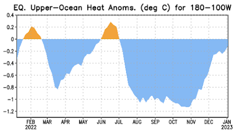
But this year La Nina appears to be following a different playbook, with Calfornia being pummelled with uber-moist storms. And La Nina is about to weaken rapidly, with changes already occurring beneath the Pacific surface.
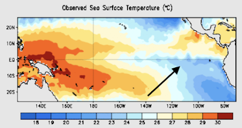
Here is the latest map of Pacific sea surface temperature. You can see the cool water near the equator over the central/eastern Pacific,
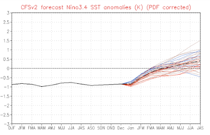
NOAA and other organizations run computer forecast models that predict the future of tropical sea surface temperatures. Here is the prediction of the tempeature anomaly (difference from normal) for the Nino3.4 area in the central tropical Pacific for a collection of many models. Virtually all are going for warming with an end of La Nina by this spring,


Comments
Post a Comment