The Northwest's Weather Scorecard at Winter's Halfway Point
We are now at roughly the halfway point of Northwest winter, and it is interesting to evaluate where we are weatherwise.
In contrast to California, which is experiencing the wettest winter in a generation...if not longer... most of the Northwest has had a muted winter so far, with the December ice storm being the main exception.
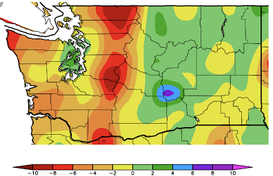
Let's start with the temperature over the past 60 days ( the difference from normal, below).
The entire region was cooler than normal by 0-4F, but eastern Washington and parts of eastern Oregon were MUCH cooler than normal...by as much as 6-8F. Not particularly surprising for a La Nina year.
East of the Cascade crest, a large area was slightly wetter than normal (green color). Interestingly the western slopes of the Cascades were below normal by 4-10 inches.
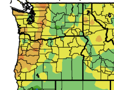


A closer-in view for Washington of the precipitation difference from normal for the past 60 days more clearly shows the dry western slopes of the Cascades, while the eastern slopes are wetter this normal.

Why this pattern you ask?
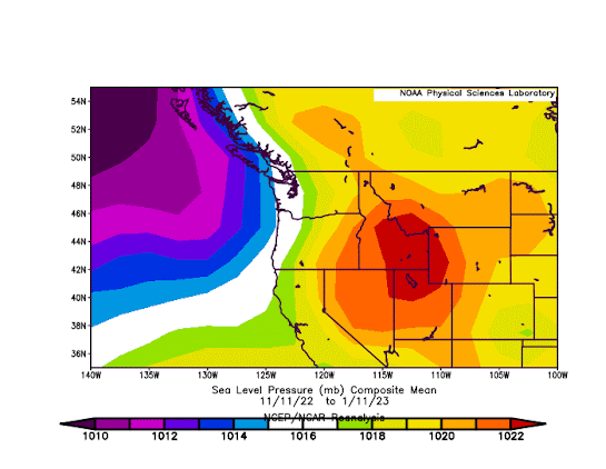
Good question! The reason is that we have had persistent low pressure offshore and higher pressure inland, resulting in offshore-directed easterly flow. So more upslope precipitation on the EASTERN side of the Cascades but less precipitation on the western slopes of the Cascades.
To illustrate the situation, below you will find the pressure averaged for the 60 days ending January 11th. High-pressure inland (red), lower pressure offshore (purple).
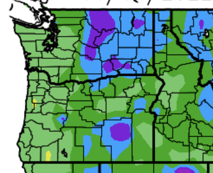
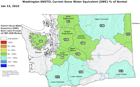
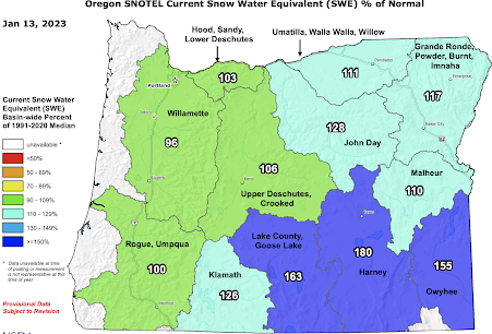
What about Northwest snowpack? As shown below, the Washington snowpack is nearly normal for this time of the year. The same is true for all of Oregon except for the southeast side, which has much more snow than normal.


At this point, I suspect the Northwest will continue this near-normal regime for a while.
The exciting weather story is California, where huge, historic amounts of precipitation--the greatest in over 100 years in some locations-- have essentially ended the several-year dry period. I will talk about that in a future blog.


Comments
Post a Comment