In a paper I wrote several years ago on western Washington snowstorms, I list several ways snow can fall in the area.
All had to find a way to provide precipitation and cold at the same time--which is very difficult in our neck of the woods.
One way to get snow...generally light snow.. is with the passage of an Arctic Front (really a modified Arctic Front, but who is checking?)
And we are going to get some snow from such an Arctic Front passage on late Tuesday and on Wednesday morning.
In a western Washington Arctic Front passage, cold air from the interior of British Columbia surges southwestward through the Fraser River Valley and jets out just north of Bellingham. The frigid flow splits around the Olympics with a river of cold air pushing southwards over Puget Sound.
The Arctic air collides with warmer/moist air to the south, pushing some of it upwards producing clouds, precipitation, and yes, snow.
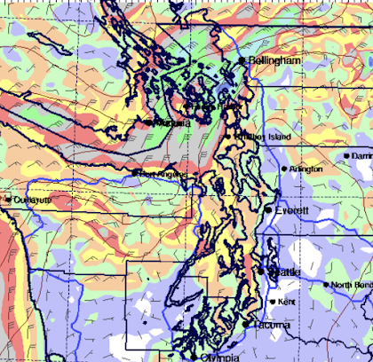
Later tomorrow, the Arctic air will push southward, as illustrated by the forecast surface winds at 10PM Tuesday shown below.
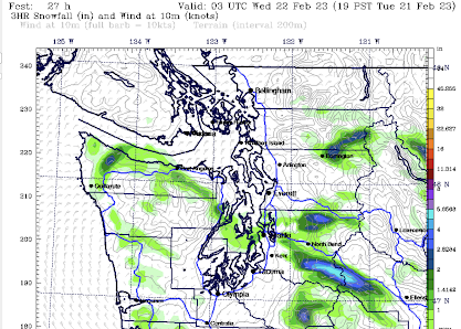
A band of snow will form at its leading edge, as shown by the forecast 3-hr snowfall total ending at 7 PM tomorrow.
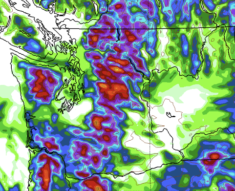
The predicted snowfall total (NOT SNOW DEPTH) Thursday morning shows .5 to 1 inch from south Seattle northwards, with more on the east side. Much more snow in the mountains A band of snow will also occur upstream of the blocking Olympics.
I don't want to hype this....not the end of the world. But many of you around Puget Sound will see some flakes. There is more snow over SW Washington, where they will get some precipitation from a weak low along the northern Oregon Coast.
The mornings the next few days will be cold....well below freezing, so be prepared.
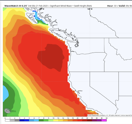
And talking about being prepared, some big swell will be approaching our coast tomorrow and Wednesday as well, with some waves above 20 ft. Strong northwesterly winds with a large fetch are a big contributor. Between the waves and the cold, not a particularly good time for cruising.




Comments
Post a Comment