Update on Tuesday's Snow Event
We can still expect to see lowland snow tomorrow, and being closer in time, I have powerful additional forecasting tools to apply.
But before I do so, let me note that there was a magnificent auroral display last night, mostly behind the clouds, and during some openings, the sky was aflame.
Here is an image from North Kitsap, provided by weather cam maestro Greg Johnson of Skunk Bay Weather. Stunning.
This is late season for western Washington/Oregon snow and temperatures are marginal. But with sufficient precipitation intensity, melting and evaporation can drive the snow level down to the surface. The result: wet snow.
The latest forecasts are converging on around 2 inches near sea level, but as we will see, there will be considerable variability.
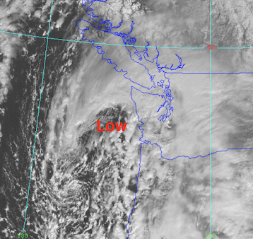
The feature of interest is a low center (and associated fronts) that is centered off the Oregon/Washington coast right now (see image). Right now some weak bands of precipitation are over land. Some light drizzle and snow showers.
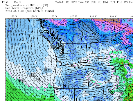
That low center will drift to the northwest during the next 24 hr, associated with an approaching upper-level trough of low pressure. The sea level pressure map at 4 AM tomorrow (Tuesday) is shown to illustrate.
Now, let's examine the forecast model output.
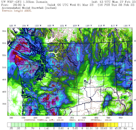
The total snowfall (not snow depth) through 4 PM Tuesday from the uber-resolution UW model is shown below. Perhaps 2 inches in the central Sound, with less over the warmer water. Similar amounts over Bellingham and the San Juans. Less south of Seattle.
The European Center model, with far less resolution, has a fuzzier but similar forecast.
If I have tried to communicate one idea in this blog, it is that forecasts have uncertainty and meteorologists must define this uncertainty and communicate it.
If only politicians, Covid-forecasters, and some local newspapers did the same.😆
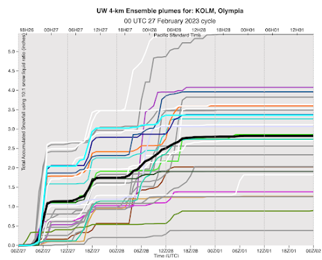
A key tool for defining forecast uncertainty makes use of an ensemble of many, but plausible forecast simulations. The UW runs one of the best such ensembles in the nation and you can enjoy the fruits of this technology.
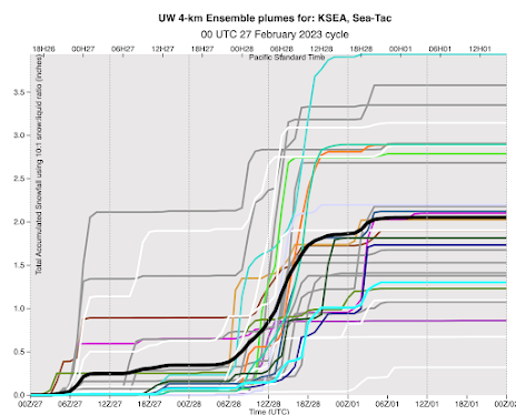
For example, here is the ensemble snow forecast for Seattle. Lines show different forecasts, with the black line being the average of all of them.
The snow revs up after 10 PM tonight (06/28), with considerable uncertainty. The average total snowfall is about 2 inches.
The European Center has a lower-resolution ensemble. For Seattle, it suggests about 3-4 inches.

.png)


Comments
Post a Comment