Record Breaking Storm Hits California. Snow Showers for Seattle. Accumulating Snow in Portland.
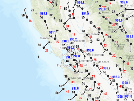
Today a record-breaking intense midlatitude cyclone has hit California--the strongest on record this late in the season. Take a look at the visible satellite image around 5 PM (below). An intense low center is at the center of the cloud swirl near San Francisco. While western WA and OR were high and dry!
A plane from Seattle to Monterey even had to abort its landing this afternoon due to large low-level wind shear. Moderate to severe turbulence was observed over much of California (see below, red is severe, yellow moderate). Not a good day to fly.
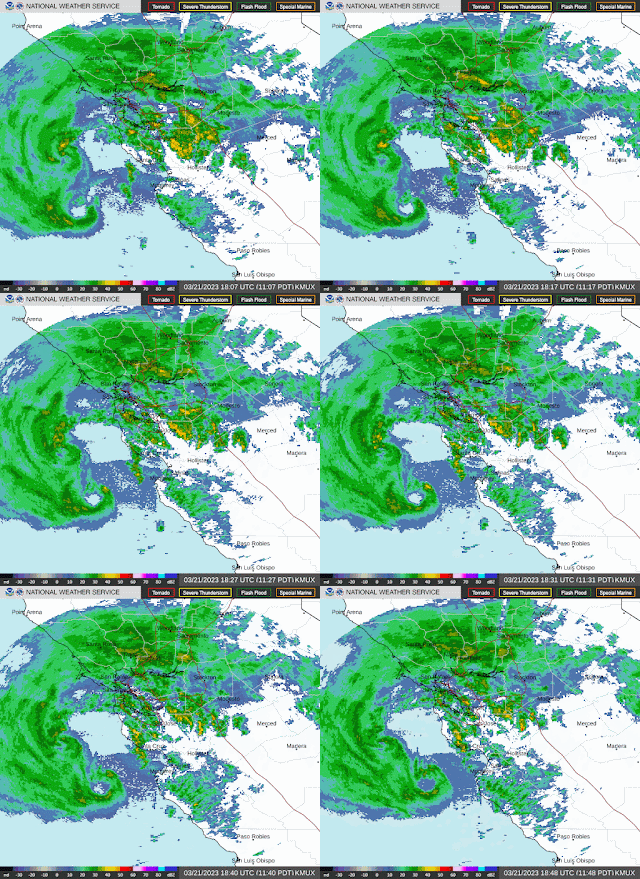
The National Weather Service radars along the CA coast revealed intense small-scale circulations embedded in the larger-scale low off the coast (see below). Just stunning.
Lowland Snow in the Northwest
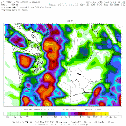
Normally, lowland snow is not an issue at lower elevations in the Northwest after early March. But much colder air will move into the Northwest later this week and there could be some snowflakes on Friday over western Washington and accumulating snow around Portland. The accumulated snowfall (not snowdepth) forecast through Saturday morning shows some light snowshowers over portions of the western lowlands. Substantial snow over the mountains.
Distrurbingly, southwest Washington and Portland areas gets more--several inches, with around a half-foot in a band south of downtown Portland. Portland is becoming the new Anchorage.😆
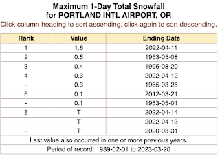
For some perspective, here are the record daily spring snowfall totals (March 20th and later) for Portland for the period from 1939 to today. The record is 1.6 inches. More is predicted by the UW WRF forecast.
In short, although there is substantial uncertainty for the lowland snowfall, there is a clear threat of lowland snow showers-- a rare treat this time of the year.


Comments
Post a Comment