Cold April Follows A Frigid March
This is turning out to be one of the coldest springs in a long time. As I noted in a >previous blog, March was uber-cold over much of the West Coast.
And now April is turning out to be frigid as well!
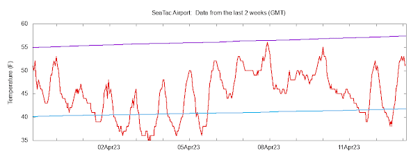
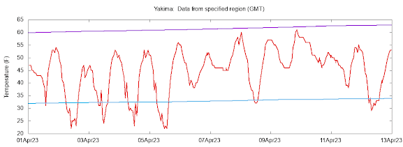
Compare the temperatures at Seattle-Tacoma Airport with normal highs (purple lines) and lows (cyan) since April 1.
Wow.... not a single day reached the normal high and many days had lows below normal.
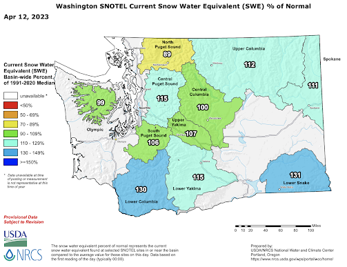
As I noted before, this cold spring is keeping our snowpack in place with minimal melting. Thus, the latest snowpack numbers indicate a regional snowpack that is above normal, even though our precipitation has been below normal.
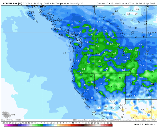
The forecast for the next ten days by the European Center ensemble forecast system is for surface air temperatures much cooler than normal (see below). It will be particularly cold east of the Cascades: I worry about crop damage from frost--so agriculture interests need to be prepared.
The NOAA Climate Prediction Center forecast concurs on a frosty forecast for the remainder of this month:
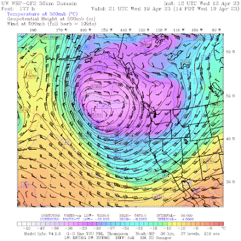
Because an unusually deep upper-level low will park itself off our coast--and it will remain there for at least a week (see forecast below for next Wednesday).
A question many of you may be wondering about regards global warming this time of the year. Have the high temperatures during the first 12 days of April trended up, down, or sideways during the past 50 years in our region?
Well, here are the mean maximum temperatures at SeaTac for the last half-century for early April. Lots of up and downs, but NO upward trend.

.png)
.png)


Comments
Post a Comment