Record March Cold Over the Western U.S. and Northern Plains
This past March brought record cold to a vast swath of the U.S., including the West Coast and the northern Plains.
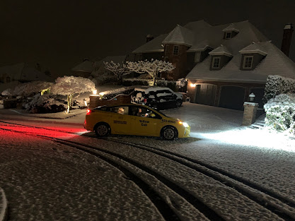
Here in Washington State, the frigid conditions even continued into April, with snow showers falling to sea-level and serious snow on some of the hilltops near Seattle (see the snowfall at 1100 ft in Bellevue on Sunday night). April?
April 2. Bellevue, Washington at 1100 ft. Courtesy Dr. Peter Benda
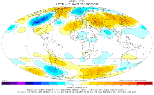
Satellites can observe atmospheric temperatures from space. The lower-atmosphere temperatures for March from such satellite (see below) indicate that the coldest temperature anomalies (differences from normal) on the planet occurred in a swath from the West Coast to the upper plains.
Portions of eastern Oregon had had their coldest March in history, as shown by the March temperatures at Burns, Oregon over the past 50 years. I mean no year was even close to March 2023.
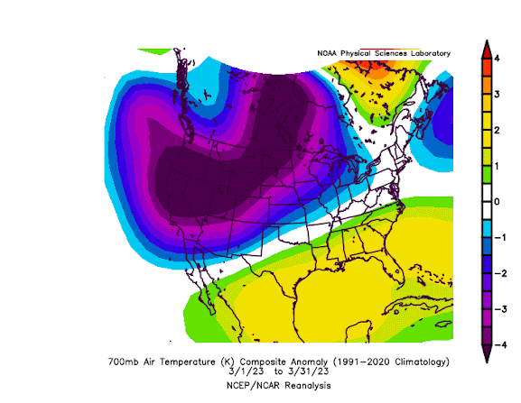
A NOAA temperature analysis that presents the differences from normal of temperatures around 10,000 ft (700 hPa pressure) for March is shown below.
Stunning. The temperatures were HUGELY below normal over the western portion of North America, but above normal over the southeast. This produced a very anomalous change in temperature (temperature gradient) over the middle of the nation.
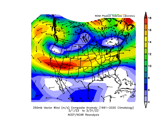
Big horizontal temperature changes are associated with strong jet stream winds in the upper troposphere. So it is not surprising the jet-stream level ( 30,000 ft, 250 hPa pressure) winds were much above normal in the area with anomalously large horizontal temperature changes (see below).Red, orange, and yellow colors show where winds are much stronger than normal, with the most anomalous jet stream winds from California to Colorado.
The large temperature gradients and strong upper winds have been favorable for the strong thunderstorms (and severe weather) over the eastern portion of the U.S.
This historically cold March weather in the west has been a godsend in one way: it slows the melting of the massive snowpack in California.
A rapid warm-up would be very dangerous, leading to serious flooding.
The weather for the next 15 days?
You guessed it, colder than normal in the West (see forecast temperature anomalies below). Blue and green colors indicate substantially below-normal temperatures.
My advice: don't think about buying tomato plants in April.


.png)


Comments
Post a Comment