The Upcoming Northwest Heatwave and Snowmelt
It is now certain that our region (and the entire western U.S.) will experience a welcome spring "heatwave", with substantial snowmelt causing a surge in river levels.
The origin of the big change is the development of a major upper-level ridge along the West Coast later this week. To illustrate, here are the forecast 500-hPa heights (think of it as pressure around 18,000 ft) for 5 AM Friday. The red colors indicated heights/pressures well above normal). This major ridge is associated with warmer-than-normal air that will rapidly sink, warming by compression.

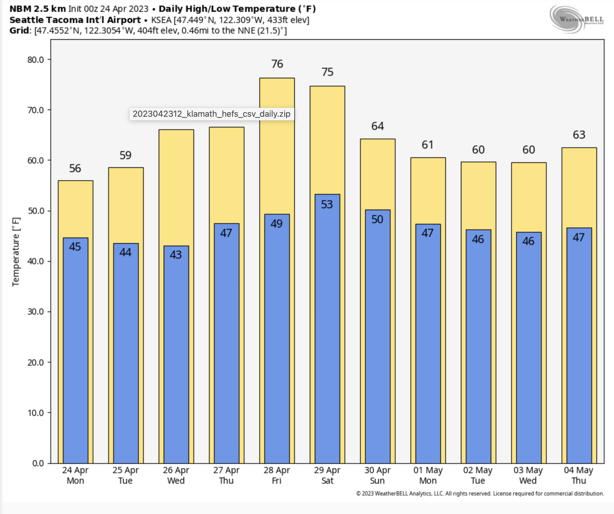
The latest National Weather Service predictions for Seattle indicate temperatures reaching the mid-70s on Friday and Saturday. Add another ten degrees for the Columbia Basin.
Folks are going to go wild after one of the coolest springs in Northwest history.
And then there are the rivers.....
Our snowpack is now above normal and this warmth will cause substantial melting of snow, particularly over the eastern slopes of the Cascades. Currently, the snowpack is above normal over most of Washington State. Way above normal in Oregon.

The surge in temperatures will result in substantial snowmelt, with some rivers rising rapidly. Consider the situation on the Yakima River at Umtahum (see below). The river will rise to near-record levels for the date by next weekend. Snowmelt inspired spring flooding was a tradition in the Northwest before the dams went in.
Folks forget that the dams save many lives and much property by storing the water from springtime snowmelt, something the anti-dam crowd should learn more about.


Comments
Post a Comment